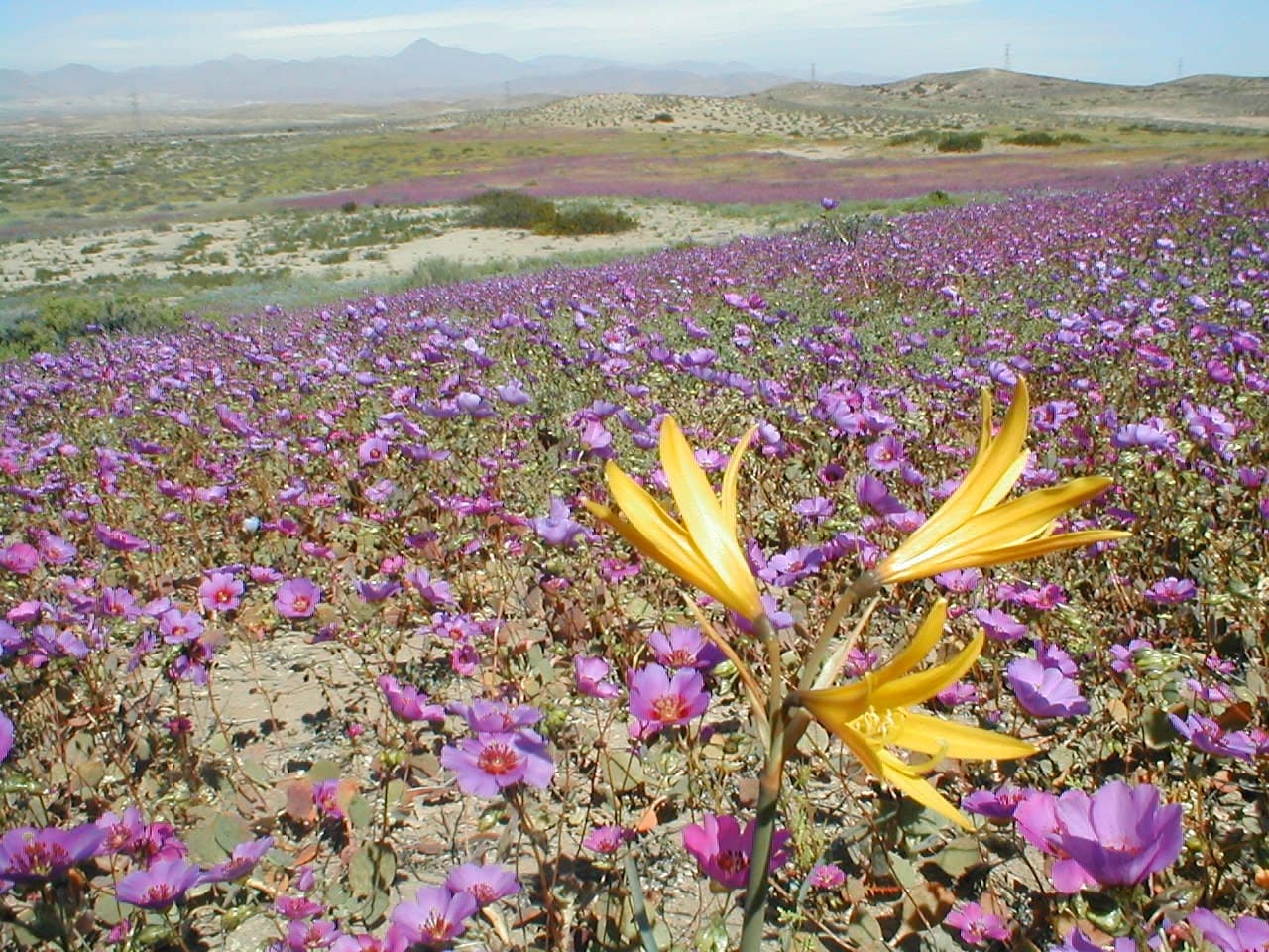
Northern Chile's Atacama Desert, ordinarily among the most arid places anywhere, has burst into color this southern spring. Researchers think the 2026 display may outstrip every flowering episode observed by satellite. NASA's Earth Observatory reported that red-purple, green and white patches spread across the desert after a winter of unusual rainfall roused seeds buried in the soil.
Measured against past blooms
Satellite records give scientists a baseline for judging this year's event, known in Spanish as desierto florido, or "flowering desert." A 2019 study drew on NASA's long-term vegetation record and counted 13 blooms in the Atacama between 1981 and 2015. Earlier, a 2014 study applied Landsat observations to chart flowering and fog-fed plant life near the Copiapó dune field.
Andres Moreira-Muñoz, a plant geographer at Pontificia Universidad Católica de Valparaíso, said the current episode "appears to be the most significant to date—in terms of its extent, intensity, and duration." He limited that comparison to the period since remote sensing came into use.
Two flowers, two moments
Landsat imagery from two dates traces how the bloom changed. NASA said the Operational Land Imager aboard Landsat 8 recorded scenes on September 14, and the matching instrument on Landsat 9 captured them again on October 24.
In mid-September, an area about 50 kilometers (30 miles) southwest of Copiapó, inside a zone flagged as a priority because of its biological importance, showed green patches topped with white. Moreira-Muñoz identified them as suspiros, or Nolana, likely the species Nolana baccata. By late October, Cistanthe had become plentiful at the same site.
Cistanthe also stood out in the October view nearer Copiapó. Roughly 30 kilometers (20 miles) southwest of the town, near the eastern part of Desierto Florido National Park, broad red-purple swaths are pata de guanaco, according to Roberto Chávez, a remote sensing scientist at the same university. He said the plants are most likely Cistanthe longiscapa, though another species in that genus is possible.
The weather behind it
NASA connects the rain to El Niño, which was gaining strength in the tropical Pacific at the time. The agency explained that during such events the subtropical Pacific high, which usually keeps northern Chile dry, loses strength, while a blocking high tends to develop in the South Pacific close to South America's southern tip. The combined effect nudges the Southern Hemisphere storm track toward the equator.
Chile's national weather service, the Dirección Meteorológica de Chile, said storm fronts fueled by an atmospheric river began arriving in mid-July. They brought rainfall that ranked among the heaviest for July in decades, over a long section of the country from the Atacama region to Los Lagos. Consecutive storms in August then left uncommon snow on parts of the desert.
Researchers in the field
Chávez's team paired the orbital view with drones and digital cameras on the ground. They photographed Nolana-covered slopes on September 24 and the Cistanthe stands on October 24, the same day as the second Landsat scene. According to NASA, the project intends to chart how the bloom's biodiversity varies by location and through time, giving conservation managers and land-use planners information to work with.
Sources
- NASA Science (Public domain (US government work))